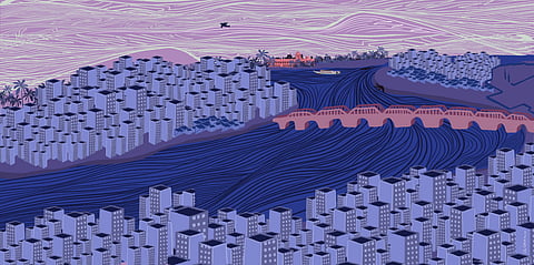
Illustration: Olokkhiart

Unreal estate

Mobile landscapes, global finance and climate science in the Bengal Delta.
(This interview is part of our special series 'Rethinking Bangladesh'. You can read the editorial note to the series here.)
Today, Southasia's leaders, analysts and scientists rightfully worry that climate events are shrinking coastlines and disappearing land masses in the Bay of Bengal. But there is a history to be charted to the current crisis.
In this interview, as part of our special series Rethinking Bangladesh, we speak with Debjani Bhattacharyya, author of Empire and Ecology in the Bengal Delta, about the effects of propertising and engineering the Bengal Delta, the histories of transformation that emerged from these mobile landscapes, the language of security around the Delta Vision 2020, and ramifications for land ownership and contemporary citizenship debates, among other topics.
***
This interview is now available on Soundcloud, Spotify, Apple Podcasts, and wherever you listen to podcasts.
[Interview transcript]
Himal Southasian: Hello and welcome to Himal Interviews. I'm Shwetha Srikanthan, and today we're speaking to Dr Debjani Bhattacharyya, Associate Professor of History at Drexel University and author of Empire and Ecology in the Bengal Delta: The Making of Calcutta. Debjani's research and work centre on understanding how legal and economic structures shape how we respond to the climate crisis, and she is currently working on her second book, Monsoon Landscapes: Credit, Climate and Calamity.
As a part of Himal's special series on Bangladesh, we're here today to discuss with Debjani, the intersections of environment, colonial urbanisation and legal technologies within the unique ecology between Bangladesh and India, how the transformation of these temporary landscapes continue to manifest economically, ecologically and legally.
Debjani, thank you so much for joining us. It's a pleasure to be speaking with you.
Debjani Bhattacharyya: Thank you so much for having me, Shwetha. It's also a pleasure to be working with Himal.
HSA: So to begin, your book Empire and Ecology in the Bengal Delta documents the various attempts by colonial powers to fortify the 'temporary landscapes' between India and Bangladesh. As an entry point to our discussion, could you tell us more about how these spaces became part of the legal, governmental and scientific domain of the empire?
DB: Thanks so much for that question, Shwetha. So there are three ways we can answer the question. There has been a substantial amount of work looking at the agrarian landscapes that are seasonal. As we know, the Ganga-Brahmaputra Delta is considered one of the youngest deltas in the world, which means they are constantly forming, re-forming and moving. It is also one of the more mobile deltas. Beginning from the Brahmaputra up in Assam, you have these char formations or island formations that are temporary, and they are all wrapped up in legal battles. Today, when we think of Majuli in the Brahmaputra, we understand that it is locked up in these enormous legal battles with ramifications for not just land ownership but also for the citizenship debates for instance.
Historians have looked at this, even before me, and I really drew upon their work. They were primarily looking at the agrarian landscape, and going right back to when the agrarian settlement happened in the Bengal frontier. If you think in terms of Richard Eaton's work, going right back up to there, what historians have documented is that agrarian landscapes that were these temporary landscapes were also extraordinarily fertile landscapes, rich in sediment and minerals. So the way of managing these landscapes prior to the coming of the British Empire was very much based on an idea of yield. And there were a whole host of laws: if the islands were in existence for 12 years, they entered their revenue roll, and if they were not, they didn't enter the revenue roll. Just because it was not part of the radar of the state, it didn't mean that people were not working on it. These were actually speculative landscapes. It's very clear if you look at the historical archives, that people would take risks at the time. And then the char chapori – they would actually try to settle these landscapes once the grass would start growing on it. So the British actually took over quite a bit of the existing laws around chars, especially those relating to the 12 years of existence to enter the revenue roll.
Here the challenge for the historian comes in – because if it's not part of the written archive, you have to start looking where else you might find records about this. What Nitin Sinha and Rohan D'Souza, what both of them showed is, they were managed by what's understood as financial buffers – people who were speculators who could invest money in actually having these lands cultivated, and they were based on yield and not on measurement, which is what defined the difference between the cadastral mapping of settled landscapes versus yield-based understanding of these spaces.

So how do we understand that this reclamation-based urbanisation became so dominant in coastal cities?

In a much more recent article – two years back maybe, Erica Mukherjee has shown and made the argument that the failure of the 1793 Permanent Settlement should not just be treated as transformation of land ownership that failed. It's that, but it's also this temporary landscape. And she's looked at all the embankment fights over these landscapes and said that they were all trying to settle an impermanent land.
For me the question was, if that's how they are settling agrarian landscapes where you can actually have – within the larger colonial capitalist machine – you have the yield measure to actually manage these landscapes, what do you do when it comes to urban spaces? Because Dhaka has a very similar history, it is surrounded by rivers and Kolkata has a similar history. When I enter the colonial archive through the existing colonial urban historiography, the story is very much a story of "there were swamps, there were marshes, they were drained"; it was a story of marsh to metropolis. There are actually two books with this title "Marsh to Metropolis".
Colonial historiography would say it was British perseverance – they saw these marshy lands, they drained it, established drainage patterns. There's quite a bit of work, and I'm not denying that drainage didn't happen. But so much of this history is written based on municipal reports, and anybody who lives in Southasia, or even has engaged with Matthew Hull's work – we know there are reports and then we know there is life that bristles outside of the report. There is often a mismatch. So I wanted to document this story. There are these reports out there, but sometimes when we look at Calcutta in monsoon, it doesn't look very drained. We know what happened last week [October 2021] in Calcutta. Half of New Town was waterlogged, and there's all these questions of what have we done wrong? Of course, all of us know what we did wrong.
Society for the Diffusion of Useful Knowledge engraved map with pictorial inserts of Calcutta, published in 1842. Photo: Wikimedia Commons
So I wanted to ask this question, if it really was drained, why is it that during monsoon we stand in sheets of water. And 'sheets of water' is not my term, I think if I recall correctly, it may be Canning's term, because Lord Canning was really worried why Calcutta turned into a sheet of water every monsoon. So something hasn't happened with this marsh to metropolis. As an idea, it is an exciting idea to run with, in some ways for the colonial officials to talk about their perseverance, for postcolonial historians to talk about disciplining the space. So I wanted to talk about what is happening to these temporary landscapes in an urban context. And that's where I realised the work of law.
Administratively these lands have to get fixed for us to then reclaim the land. Reclamation is not just going and taking over or fortifying the land – a lot of paperwork emerges. In a way, what I charted was how these kinds of temporary landscapes– I looked at the water banks, disappeared harbour at the edge of the Sundarbans to see how these kinds of lands first enter the lawyers' desk, they adjudicate upon it, or the mappers' desk, then they move on to the revenue department, to the speculators. So how these lands actually move through these various domains – I wanted to chart that story. The first set is the lawyers, the second set are the engineers, and the third set are the speculators. And how do we tell a story that actually involves these three kinds of domains?

They say this is uninsurable, but they also say that if we can come up with a green solution or a financing solution to this problem in the Indian Ocean, we'll have solved the world's problems.

That, in some ways allowed me to also understand what is happening with the wetlands, for instance, that flank not just Calcutta – if you think about it, wetlands and mangroves are central to Mumbai's reclamation, you see that in Jakarta, you see that in multiple Asian cities. So how do we understand that this reclamation-based urbanisation became so dominant in coastal cities? Philadelphia's story is the same in some ways. Once I started living here I realised, it has also been recovered from the swamps.
Just to add one thing, currently, I'm looking at a lot of maps of Kolkata, and it is very interesting – what I'm documenting in these historical maps is that a lot of places are mapped out as tanks (or tallah is the word they are using in the maps) and then a few years later they are becoming grounds. And the name of tank or tallah gets taken away and instead of a blue marking, it's a green marking in the map. So you can chart a history of reclamation over there. But what's very interesting is some of these spaces which were marked out as green land in the maps continue to be tanks in Kolkata. So there is an interesting story to be charted in the bureaucratic regime, and I wanted to see what the disappearing of these kinds of spaces in the map means and the power of that in then setting in motion this movement [of land reclamation]. Some very exciting work is coming out. Bhavani Raman is working on the Ennore creek in Chennai, which continues to exist but you won't see Ennore as a creek in the map. It is a space. So there is an interesting story to be told in that way.
HSA: Because this landscape is so unpredictable and humans respond to that in certain ways – you could say that this dynamic opens up some of the problems that perhaps lead to the climate crisis today. So, what are some connections that can be drawn between British imperial expansion in the Indian Ocean to the contemporary financialisation of climate threats? And did these histories shape how we define climate threats today?
DB: That's a question that I'm actually grappling with in my new work, and I should say it began with what they call the 'serendipity in the archive'. When I was finishing my older project, they gave me a wrong file, and these were files debating shipwreck cases in the Bay of Bengal. So one of the things that I'm trying to understand is – once I began this project, I've been reading a lot of the insurance and reinsurance companies' reports on the Indian Ocean. From 2005 onwards, post 2005 Tsunami, the Lloyd's began doing risk assessments projects in the Indian Ocean. And one of the arguments that has emerged from the debates is that the Indian Ocean is one of the most uninsurable areas, or the insurance has to be really high. These are major reinsurance companies like Swiss Re, Munich Re, major conglomerates involved in this. What happens is, when you say that, you actually affect a sort of capital flight, vis-a-vis infrastructure and goods.
So there is that story to be told. We know that all of these major infrastructures that's coming across the Bay of Bengal and the Ganga-Brahmaputra Delta, all of the dams happening in the headwaters of the Brahmaputra, to all the major ports that are coming up along the coasts from Sri Lanka, right through India, Bangladesh, the coal plants in the Bangladesh Sundarbans – there's a large insurance structure involved.

They've been understood as scientists in the historical archive, but no one has read them as people who are working for these insurance companies and adjudicators of these cases.

Of course, Asian Development Bank (ADB) has taken a very different approach, vis-a-vis Lloyd's. But the language of the Lloyd's is very interesting. They say this is uninsurable, but they also say that if we can come up with a green solution or a financing solution to this problem in the Indian Ocean, we'll have solved the world's problems. Most densely populated area, the poorest live in this area, most of the things are not titled so there is a lack of a paper regime, so the response has to be a really complex response. And they do fund a lot of research. So quite a few of the climate research that you see in universities– indeed people who are writing Lloyd's climate reports are Oxford climatologists and meteorologists. I believe quite a few Ivy League universities here who do this kind of climate research in a really nuanced way, but the money is coming from these kinds of major insurance companies and asset management companies. We often like to tell the story of big corporations wanting to do climate denialism – and they do – if we look at BP and Shell, but once we turn around and start looking at these financial institutions, they are right at the cutting-edge of climate research. They want to understand what the dangers are.
But then I realised, as I put on my historian's hat, it's not actually unknown. The Royal Meteorological Society in London was established by the Bank of England and Lloyds. It's a longer history and they do want better data about this. So that's when I started digging, I am still in the process of digging, but the puzzles that I have are this: if you look at the Lloyds archive, through the late 18th and the 19th century, much of it's investments and profits are coming out through this insurance out of the Bay of Bengal and the Caribbean. It's not the calm waters of the Baltic or the Mediterranean. And we know that a huge amount of shipping was moving through the Caribbean and the Indian Ocean waters at this time. The world's GDP and the world's trade is moving through and economic historians have documented it. But this is also two of the more turbulent spaces wracked by tropical cyclones and hurricanes. So once I started digging into these marine court records, what I saw emerging is a particular way of assessing, understanding and financialising storms. In fact, the people who did the early research on storms and how we recognise and measure a storm comes very much out of the people who were doing the adjudication of these [insurance] cases. In the Caribbean, the person who was doing research on hurricanes was also an insurance court lawyer, and also Henry Piddington over here who was doing research was also a court lawyer. So they've been understood as scientists in the historical archive, but no one has read them as people who are working for these insurance companies and adjudicators of these cases.
Currents in the Bay of Bengal. From 'The Bay of Bengal Pilot: A nautical directory'. Compiled by James F. Imray. London, 1879. Photo: Picryl / British Library
Just to wrap this discussion, the fact that the hurricanes scale, category 1 to 5, that scale known as the Saffir-Simpson scale particularly, comes out of the measurement of wind's impact on buildings. So a civil engineer worked with a meteorologist to come up with that scale. The scale comes out of the damage caused to a building, measured based on the property damage claims that people have made. It's very interesting that the financial schema has allowed us to understand the impact of winds, which we call cyclones or hurricanes, as that. When you look at the historical archive the whole challenge is, when you're on a deck in the middle of the ocean, how do you recognise a storm as a storm and not just strong wind? And that's where much of these insurance claims are being fought. Did you recognise that as a cyclone or did you not? And what went into it. It is this act of visual training of the eye to recognise and then steer a ship accordingly.
In the last year, there's been a lot of pushback from scientists, particularly in the US who are doing hurricane research – it's very interesting –  saying much of our hurricane measurement as we do this hundred year mapping of cyclones and hurricanes, is so much based on the impact of these cyclones have on human settlements, and therefore are all wrong because when a cyclone rages through a place which is empty – be it a desert or the prairies – we do not have the measurement for that. Our scale is completely skewed. Because it's based on its impact on a building, bridge or human-made infrastructure, that we have not actually developed proper scientific measurements for these things. I'm trying to understand, especially in the Bay of Bengal (because when I look at these shipwreck maps – it would be wrong to say Indian Ocean because most of the shipwrecks technically happened from Chittagong right up to Balasore – that is the area), why that happens, I still don't have an answer. I'm just collating through the annual reports that they produced of the shipwrecks, but that seems to be the most turbulent place. And we know, going back to talking about the independence of Bangladesh, one of the worst cyclones, the Bhola cyclone of 1970 also happened in that region. And if you really zoom in on that, that's where exactly annually you see the highest number of Indian Ocean wrecks happening.
HSA: That's fascinating – thank you. And in your book, you write that "For a tidal landscape like Bengal's, maps are merely a snapshot in a much longer timeline of sedimentation. Cartographic techniques fail to depict the temporality that defines land–water relations in the Bengal Delta." So the colonial administrators tried to fix land in time and space in order to turn it into a resource, but at the same time the fluidity of the landscape itself created opportunities for profit and accumulation. Could you tell us more about the limits and paradoxes of this 'cartographic-mindedness'?
DB: A lot of people have already done a critique of 'cartographic-mindedness', I think of James Scott's Seeing Like a State, about legibility and homogenisation of landscapes by doing cadastral mapping. But that feels like the mapmaking ways of seeing space is top-down or oppressive, and for me that failed to answer the question about how these kinds of spaces actually created various kinds of opportunities for the state.
As I was doing this work, there were two ways to go about it. Of course, there's all this new materialist kind of historiography that people talk about, like Vibrant Matter, and how nature actually pushed back – I have no problems with it per se. Legal historians have also made the argument that some of these island spaces and networked places were almost limits to imperial expansion. You can't make those arguments in the Bengal Delta. This is really where the [East India Company] factory really started thriving and took over half of the Indian Subcontinent from, and this is a very mobile landscape – we forget that. Climate change today has given us a language to understand what's happening in Bangladesh and the eastern coast of India. But if we go back 40 years later, if I were to say this is a mobile landscape, it is actually a term no one would even accept – it's almost like a dissonance, that term. So how do we understand the fact that there was a deep awareness of the mobility of the landscape? James Rennell who was actually mapping this whole area, he's coming to court and saying maps don't represent the reality on the ground over here. So what exactly is happening? This is not a story of limiting the East India Company, as much as we want to tell that story, it is not. It just chugs on and continues to profit.
So in a way, what I realised is these spaces actually become sites of establishing emergency provisions. The government says land that is newly formed becomes Company land if it is not attached to anyone's property and if it's not fordable. And fordability is a very interesting category. Anyone who's lived along a tidal area knows fordability is completely based on the tides. It could be fordable during the morning and it could be not fordable in the afternoon, depending on the tides and when you measure. So there's a lot of legal debates on the foreshore, high tide mark, low tide mark – these are very important debates.
Engraved map of Bengal, Bahar, Oude, and Allahabad with part of Agra and Delhi exhibiting the course of the Ganges from Hurdwar to the Sea. By James Rennell. London, 1786. Photo: Wikimedia Commons / Rijksmuseum.
At the moment, I'm working on how they take the Bengal Alluvion, Diluvion law that tries to regulate this landscape, and make this what I call the 'quasi eminent domain claim' and as East India Company they rule by the double powers of the sovereign (which they are drawing from the English sense of ownership) and the zamindar over here. So we actually have the double right to make these claims on the land, they say. But the Bengal Alluvion and Diluvion law then gets taken up, debated through the 1880s and made into an all-Indian Subcontinent kind of law. And what they say, within the empire, there are multiple kinds of spaces. There are arid spaces, seasonally dry spaces, engineered spaces of the Canal Colony in Punjab, there are coastal spaces on both sides of Ghats. So how do we take this law and apply it all over? Bombay Presidency goes in an interesting direction – they say all this reclaimed land is company land, because it just opens up too much. Central Provinces were different – they said we need to train the army and train the Patwaris, the revenue collectors in mathematics, so they can measure what happens. If you look at the Bengal Presidency, they go a completely different way, they actually try to regulate with the 12-year law constantly.

Climate change today has given us a language to understand what's happening in Bangladesh and the eastern coast of India.

What we know today from the lower Bengal Delta, between both India and Bangladesh, a lot of these lands are called bada zameen, (BADA) Bengal Alluvion and Diluvion Act, so the act has become the name for these kinds of spaces. So what I tried to look at is how the formation of new land actually created legal machinations. What's its effect in the present? There's very interesting work coming out, particularly out of Bangladesh. Whenever there is a shift in the rivers, be it the Meghna or the Padma, what you see is often the choruas, the people who live in these chars actually work with the district magistrate, and work with the older pattas and try to move to these new chars and actually sort of lay it out on a stencilled map of the new char and divide it up – interestingly, to give it back to the old choruas (older residents). So that's one way of managing it.
There's another way of managing it – there's a shadow economy of dredgers that have also emerged, especially in the northern waters. The confluence of the Brahmaputra-Meghna and Padma is where whenever these people lose these seasonal lands, there's an entire economy of dregers who actually try to dredge up lands for exorbitant fees so that the people can make land claims and say that I owned that land, the floodwaters had washed it, so I actually can make a new claim on a newly formed land. So there is an entire economy that has emerged out of these mobile landscapes and that has to be charted in a much more robust manner, and conversation with the Indian side, Bangladesh, Assam – all together, because this is a kind of a fluid landscape we are dealing with over here.
HSA: And going back, from the various Bengali folk songs, paintings, and also almanacs, theological imaginations of the delta by indigenous communities mentioned in the book, what can we learn about ethical limits of fixing land and water in space, in contrast to the colonial officials' direct approaches?
DB: This is a very tricky question and I grappled with it a lot when writing because the urge of the postcolonial historian is to kind of romanticise the past, right? And to say that there are certain kinds of indigenous knowledges we can learn from. And I'm not saying we can't learn from that, what I'm saying is, we can go back to the past, grab something and kind of mobilise it for the present, and there is also a violence to that act. Why I say violence is that the glorification of indigenous knowledge has entered the UN language. The UN will say in their SDG's, let's go back and look at how these communities have developed long-standing resilience and learn from them.
People bathing and praying in the Holy River Ganges. Gouache painting on mica by an unnamed Indian artist. Date unknown. Photo: Wikimedia Commons / Wellcome Library, London.
There is one way of rejecting this and not wanting to romanticise the past. For me, the challenge is, how do we read this as neither the enchantment of the past and the violence of the present? How do I read this as a kind of knotted activity? And here I drew a lot from Gautam Bhadra's work on almanacs, where he is trying to look at the emergence of this knotted kind of a temporality. How do I actually find these kinds of habitations, which look strange to us but remain within this kind of a colonial bureaucracy? So I looked at how the colonial officials engaged with this one particular Hindu deity who actually gets compensation. I'm trying to understand how a rational, colonial bureaucracy in the 19th century actually accommodated something like a sacral space. And they actually do, they constantly do. Any kind of infrastructure projects, they try to work around it.

If you look at the deha-tattva traditions of the Bengal area, it's also a philosophical space of passing and coming to your own, rivers are sites of markets, sites where you make money, rivers are sites where you fight out battles, you interact in a more than human way with the biota.

But there's another thing that's happening. As I'm reading a lot of early texts about monsoons and cyclones, If we begin with some of the early Islamic Hanafi text about laws of the sea, some of the injunctions that are out there are saying, to go out to sea [and getting wrecked] during monsoon by a merchant is actually haram and it's blasphemous, you do not become a martyr by doing that – you actually are committing blasphemy. I was also recently reading this text called the Maharashtra Purana, that's an 18-century text, and it talks about how if you try to invade the Bengal area in monsoon, you can't be greedy and you cannot invade during monsoon. So it almost seems that there are financial ways of dealing with these risks. We can read them as ethical limits, but we can also read them as, it's financially a stupid venture to go out to sea during the monsoon weather, or it's a stupid venture to take my elephants out into Dhaka or Murshidabad and not be able to wade through this knee-deep water. So there are other ways of reading it, and I want to think a little more carefully about doing the ethical move, and ask, are these actually ways of also insuring? Are these actually ways of managing risk in the early modern period and what is happening? So they're saying it would be financially disastrous to go and start raiding Bengal at this time. There are ways of managing.
Present-day pictorial scroll depicting scenes from the kavya Manasamangal (undated), From Medinipur, West Bengal. Photo: Wikimedia Commons
What I found interesting during my book, looking at some of this is, how much the river features as a space of habitation and how silent the colonial archive is about the waterways as sites of habitation. And that is the conundrum I tried to work within the book. Why is it that there is no distinction between land and river? It's always a space of habitation, a space of passing. And if you look at the deha-tattva traditions of the Bengal area, it's also a philosophical space of passing and coming to your own, rivers are sites of markets, sites where you make money, rivers are sites where you fight out battles, you interact in a more than human way with the biota. But when you look at the colonial archives, the rivers are something you have to pilot, it's kind of dangerous, all these people are smuggling rice – it's a very different river that emerges. So I wanted to work with that, what is it that a certain group see the river as [something], and another group of people fail to see the river as [that].
HSA: You have also recently also written about Delta Vision 2050, and how it proposes the development of bilateral alliances between India and Bangladesh in order to address "environmental security issues". This project could also potentially involve the relocation of populations from vulnerable areas. So what would a managed retreat in the Sundarbans mean?
DB: What is very interesting about the Delta Vision language is the language of security. And the language of security also alerts us to the fact that we look at climate change as a security issue only when we think of huge movements of populations. How do we manage the movement of people? And how do we manage the movement of people who are actually the most vulnerable, the people who are most vulnerable, often the poorest. Basically, it is a management of poor people's movements, is what we're talking about – which in a way is very upsetting when you read the language of the Delta Vision. It is very much about protecting the animals, it is very much about protecting the forests. If anybody reads Annu Jalais's work, which will alert you that the forests are products of human labour. Forests are not just trees and animals, it's human beings in it. But the Delta Vision completely empties out the forest of humans. I'm still trying to wrap my head around this and I'm also working with Megnaa Mehtta, who works on the Sundarban.

How do we read this as neither the enchantment of the past and the violence of the present? How do I read this as a kind of knotted activity?

Coming to the question of managed retreat, let's see where managed retreats function. So the argument for managed retreat is, instead of letting people move when they feel like it is time to move, the government should do a top-down management of moving people. In the subcontinent, we have deep experience with development-induced displacement, we can call this climate-induced displacement, managed by the government. And our experience of development-induced displacement has been if anything but horrific if we look at the data that comes from the 1940s onwards, definitely very well from 1960s, 1970s – it's been a horrific kind of a tragedy, if we want to use that term.
Sentinel-2A satellite image of eastern part of the Sundarbans in Bangladesh. Photo: European Space Agency / Wikimedia Commons
So where has managed retreat been successful? The case that is often cited is what happened after Hurricane Sandy in New York. The way that the story will be told is it's a democratic decision by the people who were living in Staten Island, where the State of New York bought back their lands because their housing was built in the 1970s and 1980s on floodplains. When Hurricane Sandy displaced the populations, they were bought back and moved to higher grounds within the state of New York. Now if we drill down into the details,  we're talking about a primarily white neighborhood, which has often voted Republican in this country. And that's the success story we tell. We move around and look at the Black neighbourhoods, that has not happened – they've resisted planned retreat, they are considered truant, and that they do not understand climate change. If we go down to New Orleans, where planned retreat has been unsuccessful – it's often the communities who are indigenous communities who are living on the edges, who continue to want to live in that area. So we're taking the experience of this one particular community – of a successful, democratically-driven planned retreat and trying to impose it within this Bengal Delta area.
Should people not move? Yeah, they should move if the need arises, they should move and there should be a clear articulation. Megnaa is actually doing a lot of work where she is trying to show how within the islanders there is an entire range of difference [of desires]. Who are the people who want to move are often shopkeepers, are often people who have another house somewhere on the outskirts of Kolkata – they are for planned retreats, they are taking an initiative. But there are people who don't want to move. What they want is maybe better embankment, maybe what they want is lights, better hospitals. But we don't want to pay attention to that.

We look at climate change as a security issue only when we think of huge movements of populations.

And the other argument, as we read the Delta Vision document, is very much: we have to protect the Sundarbans to protect Calcutta, of course, the financial centre of Bengal. So we are going to ask to sacrifice the lives, with dignity, of a bunch of people, to protect Calcutta. But what if we thought of it the other way around? In order to protect the Sundarbans, what if we need to do a planned retreat of the Farakka dam, which has been a thorn between India and Bangladesh, but also has resulted in the enormous loss of siltation which could have created new land in this area. Because land doesn't just disappear and dissolve, it also accretes. So we need to allow the natural accretion to continue through, and there are ways we could do that.
I know that the Bengal government is not yet excited about the planned retreat. Planned retreat is coming from a group of conservationists, and you can see the conservationists' thrust is the question of planned retreat – it is very ecology-driven, but an ecology devoid of humans. And the language of security, we know, is often the language of the threat people feel of the movement of 'unregulated, un-government managed' movement of people. And the question is, where are we going to move the 5 million people, with dignity? There are lots of questions that are there, and as I say, we always have to be weary of development-induced displacement or climate-induced displacement (managed by the government is the term I will use for the Delta Vision).
Buriganga river embankment, Dhaka. Photo: Wikimedia Commons.
HSA: And speaking of these development projects, what were the environmental effects of propertising and engineering the Bengal Delta? And in what ways do policymakers and the local governments in the region continue to exploit the delta to further their developmental agendas?
The best person here, whose work I really learnt a lot from, is Dhrubajyoti Ghosh, an environmental engineer who did a lot of work in the East Calcutta Wetlands. Dhrubajyoti Ghosh said something very interesting, he looked at the wetlands and said: "You know, Debjani, what these are? These are real estate in waiting." And the question is why is it that when we see thin sheets of water or land slightly submerged in water – we think in terms of wasteland, we think in terms of unused space, we think in terms of possible housing.
When I teach my class, I often show them this image of a sheet of water and a telephone line standing, and I say, what do you guys see? They all see a road, they will say a flooded road – they don't see just water. And that is very interesting, it is part of our visual literacy. When we see infrastructure, we see a road, we see something productive. For us, a sheet of water is unproductive. And there's a longer history to this. I wanted to understand why is it that, while we understand the wetlands, as Dhrubajyoti Ghosh's work had showed, what he calls the 'kidneys of Calcutta' because in a way, Calcutta doesn't have a major sewage treatment plant – it's one of the few densely populated cities that can use the East Calcutta Wetlands to actually treat its sewage in a very environmentally friendly manner, and it supports the livelihoods of an enormous number of fishers, aquaculturists and pisciculturalists there. Yet, we are constantly building. Our airport stands on a wetland, half of New Town stands on a wetland. And of course, today we're asking what is going on? Why is this high-priced real estate becoming dysfunctional for two weeks on an end when we get a little bit of water?

The question of planned retreat – it is very ecology-driven, but an ecology devoid of humans.

And it's very interesting that the whole debate [in October 2021] centres on the Bagjola canal. They are looking at these small shacks; the tea shack, the ironing man's shack, and saying oh this is the problem that's clogging up the canal. If this canal was unclogged and dredged, we would solve the problem. Because the idea is, we will not stop building on the wetlands. We'll continue to build, but let's remove some of the informal settlements that have opened up. But all these gated communities need these informal settlements to keep services running.
So I wanted to go back. It really took me back to the early 20th century, to the early rent debates that are happening in Bombay, Calcutta and Rangoon. And they're all talking to one another. What emerges from these rent debates is, who is a good land developer? Bombay is locked by the sea, Rangoon and Calcutta are locked by the river and wetlands, so what do we do? So the good developer is one who drains the swamp and builds housing. We saw that because the housing pressure is huge in these cities, no doubt about that, and we are going to continue to urbanise in a radical manner over the next 50 years, half a century. Of course, the housing demand would be high, but why did we not come to imagine these wetlands as living infrastructures that support the city, as vital public utility services that support the livelihoods of people? We only looked at them as, to quote Dhrubajyoti Ghosh, "real estate in waiting". And that is the consequence. We think we're going to continue to pump down cement and concrete and protect ourselves from climate change and all the threats.
When I finished the book it was still not accepted as common sense, but I think today it is slowly becoming accepted that we're not going to get out of this problem by concretising life and livelihoods. Hopefully, we will get to a point where we won't be doing that.
HSA: Just to follow up on that, what are some of the visible impacts on these landscapes after the use of these environments as sites of profit-making?
DB: That's the present crisis that we are facing. It is a whole host of things. First of all, in some ways if we look at what's happened to a place like Calcutta or Bombay – currently we are building this coastal road in Mumbai, at the cost of taking over the mangrove lands. We are developing and establishing as part of the BRI Initiative, the port in Sri Lanka, which is coming at the cost of livelihoods, fishers ability to go to the coast. We also have huge fights about coastal landscapes and SEZification. The Special Economic Zones (SEZ) that are emerging in, for instance Chennai and now in Haldia, because these are landscapes that have to be put to use and cannot be left. But sometimes you also have to leave the landscape. And there are multiple debates. When I say leave the landscapes, I don't want it to go to the 'Room for the River' kind of space which the Dutch are doing, because that also comes with its own host of problems.

If all our asylum claims and citizenship claims come out of being on solid ground, because it used solely the law of the soil – what does it mean to relocate this population in the middle of the Bay of Bengal, where the soil is actually dissolving into the bay as we speak.

There is a history that has to be charted to the current crisis. And today we're going to again spend a lot of money trying to take care of flooding and everything, whereas there were other ways we could have addressed it, and we continue to still address these questions about how do we build, where do we build and what sort of livelihoods do we support and what sort of livelihoods is perhaps untenable at this moment.
HSA: To conclude, what are some key lessons that can be applied to the contemporary moment in Bangladesh, where states and various organisations today continue this process of propertising, pushing water out, looking for short-term fixes by unsettling these landscapes and the people living there?
DB: This is interesting. There are a lot of things Bangladesh, I feel, is also doing right. There are smaller projects where they are building these natural embankments where fish can pass through for instance, and they are made of bamboo, weeds, and that is working. Because what natural embankments do – unlike the major wall embankment that has been proposed in the Indian Sundarban area – it allows the people who are living there to actually take care of the embankments when it breaks.
Embankment breach in Bangladesh 2010. Photo:  USAID / Flickr
Of course, Bangladesh also has its polders that were built through the 1950s, so they learnt the lesson of the problems with these state-of-the-art World Bank-funded polders. What then happens once a polder breaks is, the villagers cannot immediately repair it, they have to wait for the irrigation department or public works department to send in their heavy earth machinery to come and do the work. So it takes the responsibility away from the villagers. But there are parts of Bangladesh where they are experimenting – I think of Sheikh Rokon's work, who does a good job of documenting it. Kasia Paprocki also looked at this one organisation, the Nijera Kori NGO who is actually trying to manage one of the polders on their own and getting support. I think there's lots for India to learn if it can, with humility, from Bangladesh about the kind of management that is going on.
But at the same time, Bangladesh is also putting a coal plant in the Sundarbans, and that will have a devastating effect. It's very interesting that we have the planned retreat Delta Vision project, but that will not even talk about the coal plant – which will have far more fatal consequences for the mangroves than a bunch of people living in there.
For me, what's also very interesting is to also chart what is happening in the Bhasan Char. And that's an interesting story which we have to understand. Because it is, again, one of these temporary landscapes, but it's where also the UN, along with Bangladesh, is relocating the Rohingya population and building camps for them to live. Here, Lindsay Bremner's work is very instructive, because she's saying if all our asylum claims and citizenship claims come out of being on solid ground, because it used solely the law of the soil – what does it mean to relocate this population in the middle of the Bay of Bengal, where the soil is actually dissolving into the bay as we speak.
So where the soil itself is untenable, it is a char that has been in existence 13 to 14 years and just about gotten into the revenue rolls, and Bhasan, it is a floating island. So it is very interesting – at what point it moves out of the Bangladesh territorial waters, what happens if it continues to move around? So there is a humanitarian experiment now playing out in the Bhasan Char, which could be interesting for international law people, for environmental historians and ecologists and people who work on refugees, to see how this story is playing out in the Bay of Bengal context.
HSA: Debjani, thanks so much for joining us and for this opportunity to engage with larger questions in historical and contemporary contexts on how colonial legal systems and urbanisation continue to reshape these ecologies. In your book, you eloquently conclude that "We easily forget. And because we forget, it is harder for us to imagine alternatives," and that reiterates the importance of tracing these environmental imaginations and histories to better understand contemporary entanglements within the Bengal Delta, and all that we discussed here today. Thank you, it's been a fascinating discussion!
DB: Thank you Shwetha, it was really lovely to sit and talk about these things with you. And thank you for all your fascinating questions and for engaging with my work.
***
This special series will be available for free. To help us continue our independent, interesting and irreverent coverage of Southasia, do check out our membership plans and support our work!
Loading content, please wait...
Himal Southasian
www.himalmag.com